Najlepsza aplikacja do śledzenia odwiedzonych stanów w 2026 roku: porównanie 14 narzędzi
Najważniejsze informacje
- 1
- 2
- 3
+3 więcej w podsumowaniu na końcu
Jeśli chcesz mieć mapę stanów USA, w których byłeś, i chcesz ją otrzymać w ciągu najbliższych dwóch minut, otwórz usa.tripprof.com, zaznacz stany i skopiuj link. To darmowe, nie wymaga zakładania konta i działa w przeglądarce w telefonie. Jeśli zależy Ci na tym, aby ta mapa była dostępna również za dziesięć lat, synchronizując się między urządzeniami obok zestawienia odwiedzonych krajów, lepszym wyborem będzie płatna aplikacja - aplikacja been kosztująca jednorazowo $9,99 to ta, którą sami byśmy kupili. Wszystko, co opisano poniżej, wyjaśnia dlaczego, w tym trzy popularne aplikacje, które pojawiają się wysoko w wynikach wyszukiwania dla tego hasła, a w ogóle nie śledzą stanów.
W tym tygodniu przetestowaliśmy mapę stanów w czternastu narzędziach, zarówno na komputerze, jak i na telefonie. Każda cena i funkcja została zaczerpnięta bezpośrednio ze stron produktów lub ich kart w amerykańskim sklepie App Store we wrześniu 2026 roku, a każdy zrzut ekranu przedstawia działający na żywo produkt.
Darmowe i natychmiastowe: usa.tripprof.com, VisitedPlaces, TripMemo oraz MapChart pozwalają stworzyć prawdziwą mapę stanów w przeglądarce bez konieczności zakładania konta. Warto zapłacić: been od REBR za jednorazowo $9,99, ponieważ oferuje synchronizację oraz obsługę hrabstw. Do całkowitego pominięcia: Polarsteps, Travelog i TravelGram pojawiają się w wynikach wyszukiwania dla tego hasła, ale śledzą wyłącznie kraje. Jeśli interesują Cię hrabstwa lub 63 parki narodowe, wybór ogranicza się do około czterech narzędzi. (TripProf publikuje tego bloga, a jedno z czternastu narzędzi należy do nas - zostało ocenione według tych samych sześciu kryteriów co wszystkie pozostałe, nie ukrywając słabych stron).
Liczba, którą cytują wszystkie inne artykuły, ma dziesięć lat
Wyszukaj informację o tym, w ilu stanach średnio był Amerykanin, a na kolejnych stronach przeczytasz, że w 12,5. Ta liczba jest prawdziwa. Pochodzi jednak z badania Ipsos opublikowanego w lipcu 2016 roku, co oznacza, że ma już dekadę, a niemal każdy powtarzający ją serwis przedstawia ją jako aktualną.
Świeższe dane wskazują na wyższą wartość. Sondaż YouGov opublikowany w czerwcu 2025 roku, przeprowadzony wśród 1 125 dorosłych obywateli USA, wykazał, że „przeciętny Amerykanin odwiedził 16 stanów poza tym, w którym obecnie mieszka”. Te dwa badania nie są mierzone w ten sam sposób, co pomijają twórcy zestawień: Ipsos uwzględniało stan rodzinny, podczas gdy YouGov go wyklucza. Kiedy porównamy dane jeden do jednego, różnica się zmniejsza, ale to najnowszy wynik jest tym, który warto pobić.
Ten sondaż pokazuje również, że liczba odwiedzonych miejsc bardziej zależy od wieku niż od dochodów. YouGov ustaliło, że „32% Amerykanów w wieku 65 lat lub starszych twierdzi, że odwiedziło co najmniej 30 stanów, w porównaniu do zaledwie 5% dorosłych poniżej 30 roku życia”. Mapa stanów zapełnia się powoli. I to jest prawdziwy powód, dla którego poniższy wybór ma znaczenie: wybierasz narzędzie, które będziesz otwierać jeszcze za pięć lat, a połowa z tych produktów tego nie przetrwa.
Ten sam sondaż YouGov szereguje stany według tego, w ilu z nich kiedykolwiek postawiło stopę najwięcej Amerykanów: Floryda 64%, Nowy Jork 56%, Waszyngton DC 54%, Teksas 51%, Kalifornia 50%. Na drugim końcu znajdują się Alaska z wynikiem 12% i Dakota Północna z 14%. Jeśli na Twojej mapie brakuje Dakot, masz mnóstwo towarzystwa.
Porównanie: 14 narzędzi, 5 kryteriów
Najbardziej użyteczna jest druga kolumna. Trzy z tych produktów pojawiają się w wynikach wyszukiwania dla haseł związanych z odwiedzonymi stanami, a tak naprawdę śledzą tylko kraje. Ostatnia kolumna to ta, którą większość porównań pomija, i to właśnie w niej darmowe narzędzia różnią się najbardziej.
| Narzędzie | Stany USA? | Hrabstwa | Koszt dla stanów | Co możesz opublikować |
|---|---|---|---|---|
| TripProf USA (web) | Tak | Tak, za darmo | Bezpłatnie | Link, 4 rozmiary obrazu, wideo |
| been (been.app) | Tak | Tak | $9,99 jednorazowo | Obraz |
| VisitedPlaces (web) | Tak | Tak | Bezpłatnie | Link, obraz, wideo |
| TripMemo (web) | Tak | Nie | Bezpłatnie | Link, obraz, SVG |
| MapChart (web) | Tak | Tak | Bezpłatnie, Plus $49,99/rok | Obraz; link dostępny tylko w wersji Plus |
| mapmaker.io (web) | Tak | Tak | Bezpłatnie | Link, osadzenie |
| Maploco (web) | Tak | Nie | Bezpłatnie | Tylko link, osadzenie, SVG |
| Road Trip Owl (web) | Tak | Nie | Bezpłatnie | Obraz z logo, nic się nie zapisuje |
| been (been.travel) | Tak | Nie | $19,99 dożywotnio | Obraz |
| Visited | Tak | Nie | Odblokowanie za $3,99 | Obraz; reklamy do momentu ponownej opłaty |
| Stampie | Tak, Pro | Nie | $19,99 jednorazowo | Link do profilu, obraz |
| Skratch | Tak, płatne | Nie | Odblokowanie za $9,99 | Obraz |
| USA Travel (iOS) | Tak | Tak, $0,99 za stan | Bezpłatnie, potem zakupy w aplikacji | Obraz |
| Polarsteps / Travelog / TravelGram | Nie | Nie | nie dotyczy | Różne |
Ceny odzwierciedlają stawki widoczne na oficjalnej stronie produktu lub w amerykańskim sklepie App Store we wrześniu 2026 roku. Ponieważ kilka z tych serwisów często zmienia plany cenowe, warto sprawdzić je przed dokonaniem płatności. Dwie rzeczy są wspólne dla każdego narzędzia przeglądarkowego z tej listy i warto je powiedzieć raz, zamiast powtarzać w osobnej kolumnie: żadne z nich nie wymaga instalacji ani zakładania konta. W przypadku płatnych aplikacji wszystkie pięć tego wymaga. Jedyne reklamy wśród czternastu pozycji występują w aplikacji Visited, która sprzedaje opcję usunięcia reklam za $3,99 niezależnie od kwoty $3,99 zapłaconej już wcześniej za regiony.
Darmowe w przeglądarce, bez instalacji
Dla większości ludzi uczciwym punktem wyjścia jest karta w przeglądarce. Chcesz zobaczyć kształt swojej mapy, a instalowanie aplikacji w celu zaspokojenia pięciominutowej ciekawości wiąże się ze zbyt dużym wysiłkiem.
TripProf USA
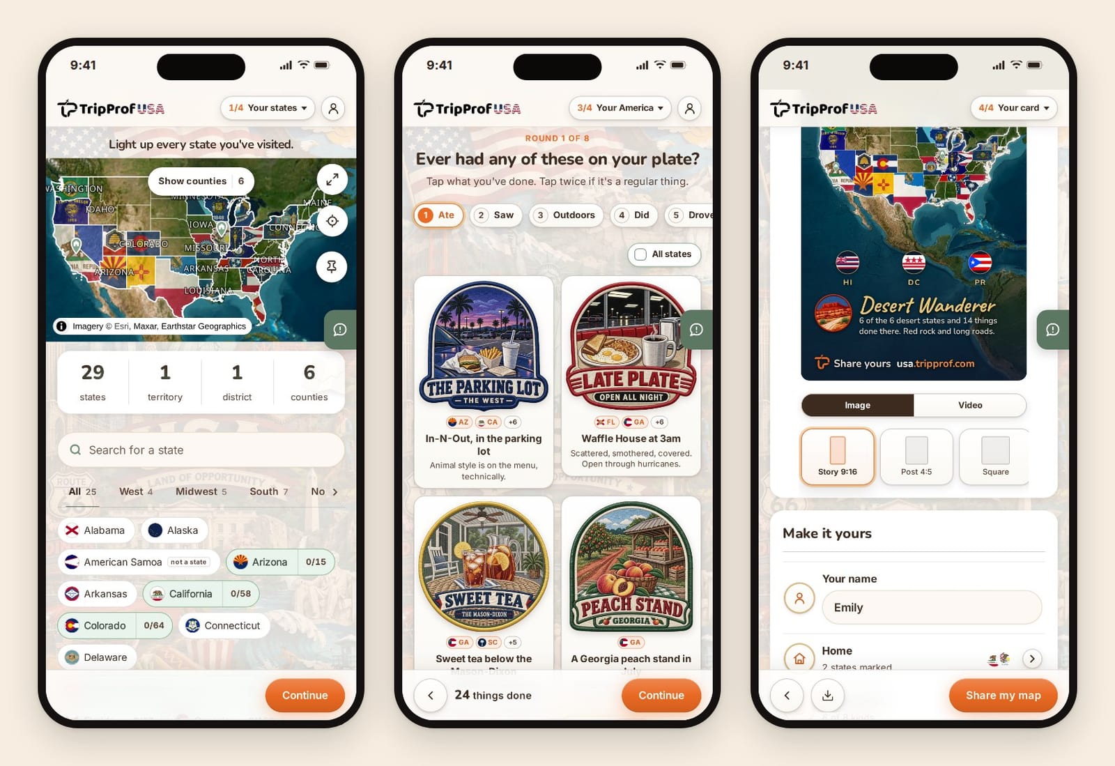
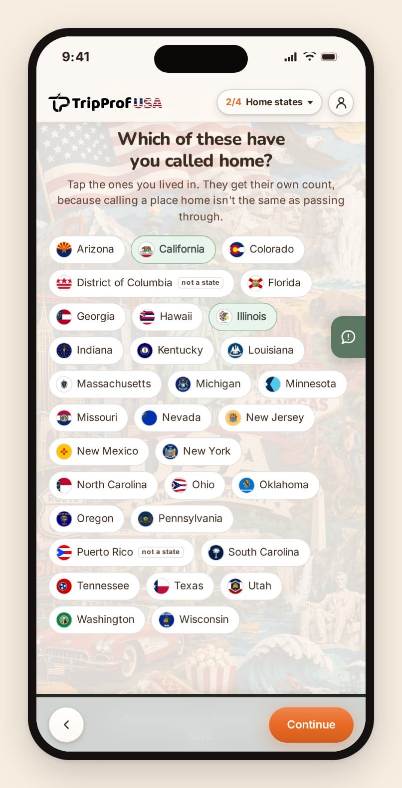
Stworzyliśmy serwis usa.tripprof.com, więc weź poprawkę na nasz entuzjazm i przetestuj go samodzielnie - zajmie Ci to około minuty, ponieważ żadna funkcja nie jest ukryta za paywallem. Zaznaczasz stany na mapie satelitarnej lub korzystasz z wyszukiwanej listy podzielonej na regiony, a każdy oznaczony stan wypełnia się własną flagą zamiast jednolitego koloru.
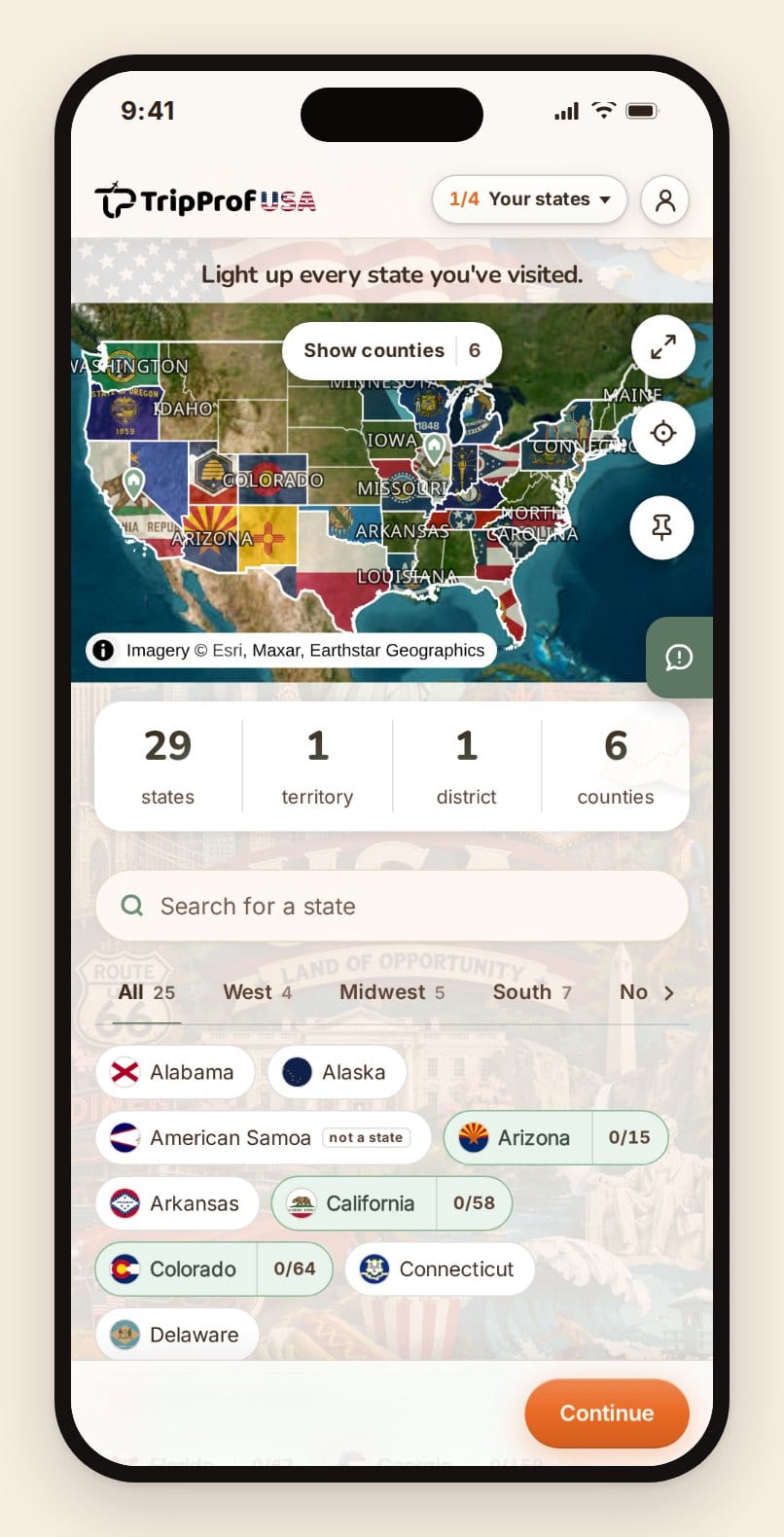
Dwie podjęte tutaj decyzje są warte uwagi, ponieważ niemal nikt inny ich nie stosuje. Po pierwsze, Waszyngton DC, Portoryko oraz cztery pozostałe terytoria są narysowane, można je wybrać i są one zliczane, ale osobno: podsumowanie ma postać „29 stanów, 1 dystrykt, 1 terytorium” zamiast łączyć je w jedną liczbę, którą inne narzędzia definiują na trzy różne sposoby. Po drugie, hrabstwa są darmowe. Po kliknięciu w dany stan pojawiają się jego hrabstwa, których w sumie jest 3 231 we wszystkich 56 stanach, dystrykcie i terytoriach - to znana z Biura Spisowego liczba 3 143 dla 50 stanów i dystryktu DC powiększona o odpowiedniki terytorialne, które większość baz danych hrabstw po prostu pomija.
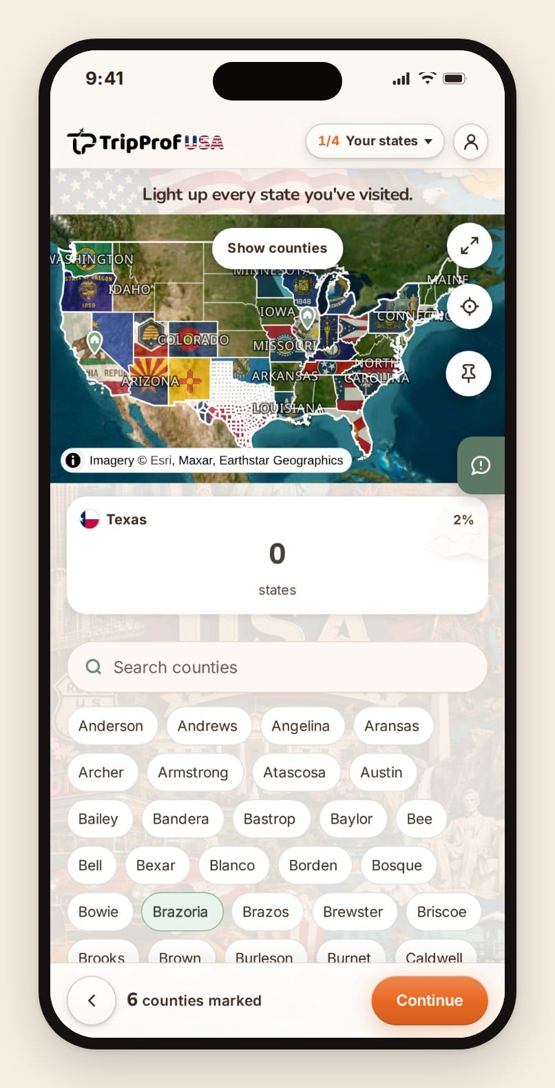
Elementem, który wykracza poza zwykłego twórcę map, jest etap następujący po jej stworzeniu. Aplikacja zadaje osiem pytań dotyczących Twoich rzeczywistych doświadczeń, opartych wyłącznie na zaznaczonych przez Ciebie stanach: wizyta w restauracji Waffle House o 3 w nocy, Route 66, dzielnica Greenwood w Tulsa czy mecz na stadionie Wrigley. Tais pytań jest 251, a kolejny zestaw pytań nigdy nie zawiera elementów, do których nie da się dotrzeć na podstawie Twojej mapy.
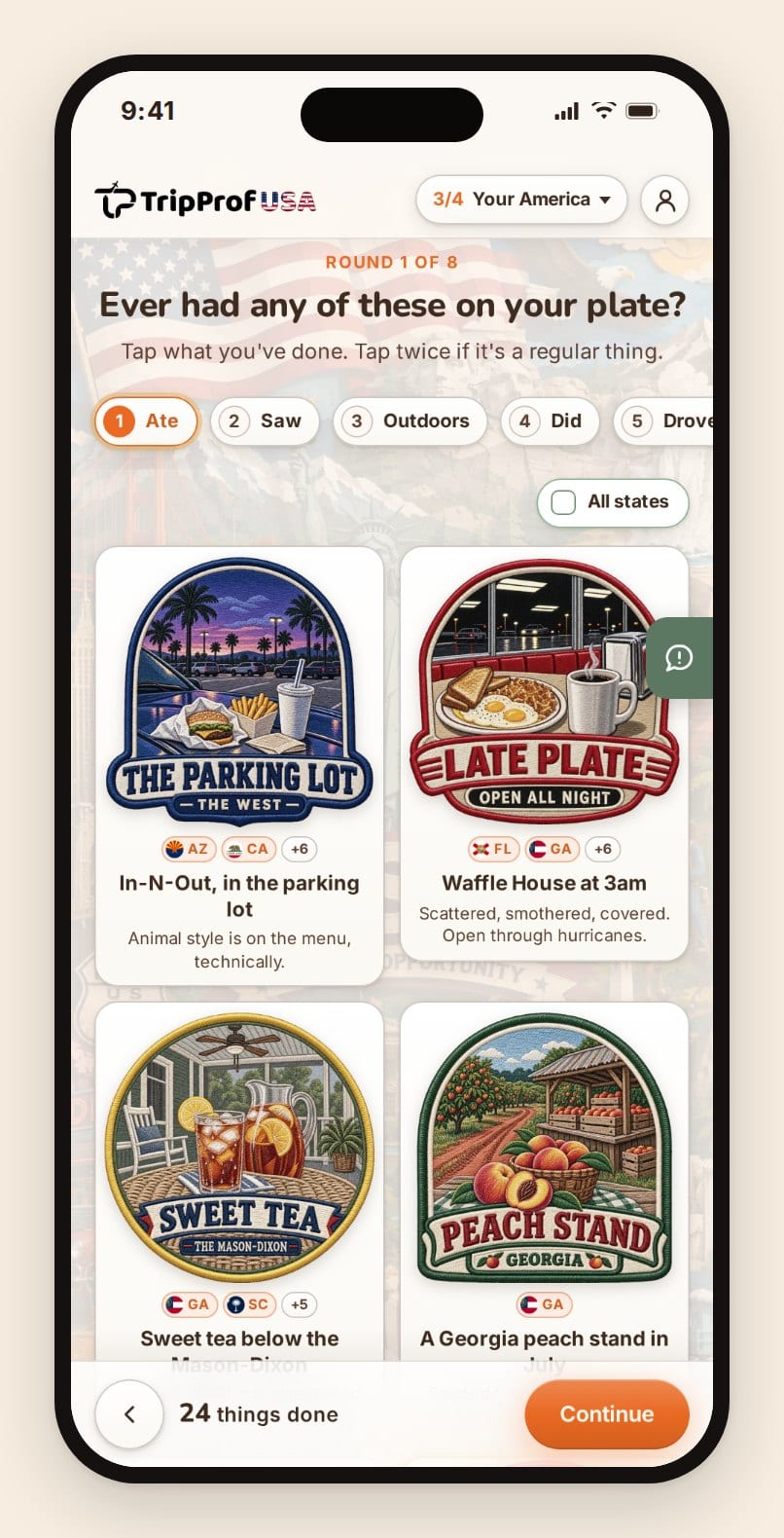
Wynikiem jest karta dostępna w czterech rozmiarach, krótkie pionowe wideo przedstawiające składanie się tej karty oraz link, który każdy może otworzyć bez zakładania konta. Zamiast suchego wyniku liczbowego, karta nadaje archetyp wynikający z Twoich odpowiedzi: Pustynny Wędrowiec (Desert Wanderer), Głębokie Korzenie (Deep Roots), Od Wybrzeża do Wybrzeża (Coast to Coast), Strażnik Parku (Park Ranger), Długa Trasa (The Long Haul) - łącznie osiemnaście różnych wariantów.
Wszystko można dostosować przed opublikowaniem. Do wyboru jest sześć stylów mapy: wersja satelitarna, terenowa oraz cztery płaskie motywy, w tym papierowy i nocny. Wybrany styl zostaje trwale wtopiony zarówno w eksportowany obraz, jak i w wideo, a nie tylko w widok ekranu. Dostępne cztery rozmiary odpowiadają formatom, których faktycznie używają platformy społecznościowe: relacja 9:16, post 4:5, kwadrat oraz szeroki format 1.91:1. Możesz zmienić nazwę na kacie, podmienić wyświetlany archetyp oraz wygenerować nowy link, jeśli chcesz, aby poprzedni przestał działać.
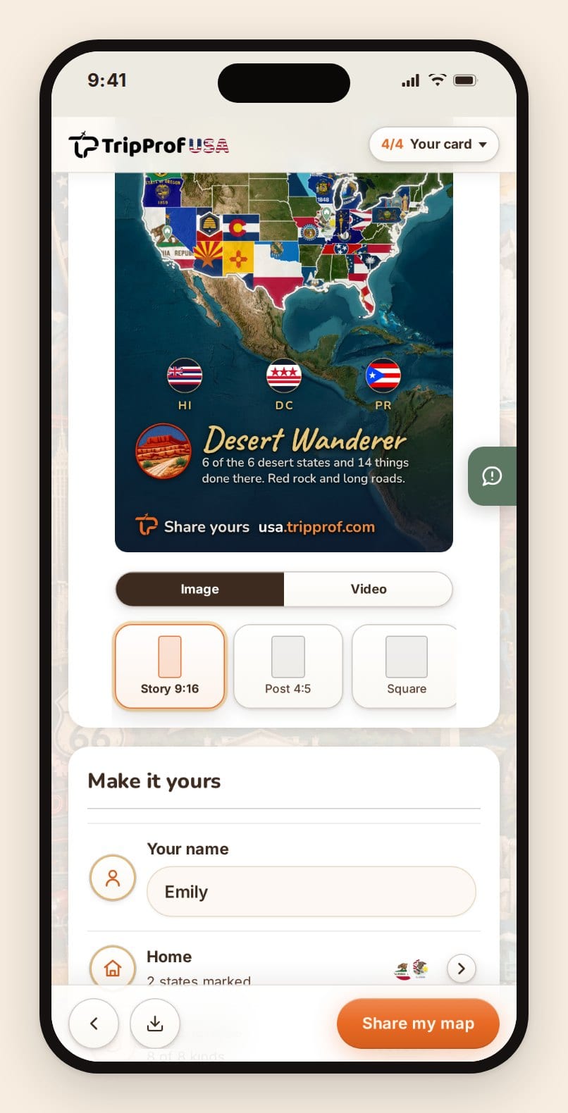
Wideo generuje się bezpośrednio w Twojej przeglądarce i zapisuje jako plik gotowy do publikacji. Tylko jedno inne narzędzie w tym zestawieniu oferuje wideo, robi to jednak w inny sposób, co opisujemy w kolejnym punkcie. Żadna funkcja na stronie nie jest zablokowana: brak instalacji, brak konta, brak paywalla, brak reklam, a narzędzie działa identycznie w telefonie i na laptopie.
W czym radzi sobie słabo: brak konta, co stanowi zarówno główną zaletę, jak i cały problem. Mapa żyje w pamięci przeglądarki oraz w skopiowanym przez Ciebie linku. Jeśli wyczyścisz dane witryny w telefonie, mapa zniknie, chyba że zapiszesz link. Brak dedykowanej aplikacji dla systemów iOS lub Android do śledzenia stanów, nic nie przypomina o powrocie i brak dat. Jeśli szukasz dziennika z informacją, kiedy gdzieś byłeś, to nie jest właściwe narzędzie.
VisitedPlaces
To dawna mapa „odwiedzonych stanów” serwisu amCharts, która obecnie znajduje się pod adresem visitedplaces.com; adres URL amCharts automatycznie przekierowuje w to miejsce. Narzędzie jest darmowe, nie wymaga logowania i obsługuje mapy z podziałem na hrabstwa. Jego twórcórcy opisują przeprojektowany interfejs słowami: „Wybierz mapę, kliknij kilka regionów i udostępnij ją światu - bez logowania i zbędnych komplikacji”.
To również jedyne narzędzie w zestawieniu, które wyprzedza nas w jednej kwestii, o której warto mówić otwarcie: nagrywa animowane wideo przedstawiające zapełnianie się Twojej mapy w rozdzielczości 1080x1920 dla relacji, w kwadracie 1080x1080 oraz w formacie 1000x1500 dla serwisu Pinterest, z płynnością do 60 kl./s. Jeśli Twoim celem jest opublikowanie wideo, to poważny konkurent, przy czym animacja dotyczy samej mapy, a nie karty.
W czym radzi sobie słabo: całkowity brak eksportu do formatu SVG - dostępne są tylko pliki PNG, samodzielny kod HTML oraz osadzenie. Ponieważ brak tu konta, nie ma też listy Twoich map: cała mapa zapisana jest w adresie URL, więc utrata linku oznacza utratę mapy.
TripMemo
Mapa stanów w serwisie TripMemo oferuje najszersze menu eksportu spośród wszystkich opcji: obrazy w orientacji poziomej, kwadratowej oraz pionowej do relacji, edytowalny plik SVG, arkusz kalkulacyjny oraz listę kontrolną w formacie Letter przeznaczoną do druku. Narzędzie poprawnie podchodzi także do kwestii Dystryktu Kolumbii, wskazując, że „Waszyngton DC jest dostępny na mapie, ale śledzony osobno. Suma dla 50 stanów uwzględnia wyłącznie stany”.
W czym radzi sobie słabo: wyłącznie stany i nic więcej, brak hrabstw, a trwałość danych jest nietrwała z założenia. Strona ostrzega, że „wyczyszczenie danych przeglądarki usuwa lokalnie zapisane postępy” i sugeruje jako obejście tego problemu zachowanie linku do udostępniania jako kopii zapasowej. To ta sama słabość, którą mamy my, wyrażona równie wprost.
MapChart
MapChart to uniwersalne narzędzie do kolorowania map, z którego pochodzi wiele map wyborczych w internecie. Obsługuje zarówno hrabstwa, jak i stany, umożliwiając eksport do formatów PNG, JPEG, SVG oraz PDF. To najbardziej elastyczna opcja, a zarazem najmniej związana z podróżami: wybierasz kody kolorów heksadecymalnych i etykiety legendy, zamiast odpowiadać na pytanie „czy tu byłeś”.
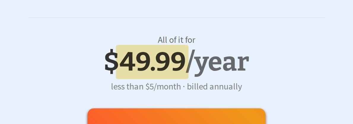
W czym radzi sobie słabo: darmowa wersja zapisuje konfigurację do pliku konfiguracyjnego .txt, który pobierasz, a następnie musisz ponownie przesłać, natomiast funkcja, której większość ludzi faktycznie oczekuje - czyli link do udostępniania - wymaga subskrypcji MapChart Plus kosztującej $49,99 rocznie. Oficjalna strona mówi o tym wprost: „Uzyskaj MapChart Plus, aby zapisywać konfiguracje map online i dzielić się nimi z innymi”. Korzystanie z darmowej wersji wiąże się również z warunkiem, który większość użytkowników pomija w regulaminie: możesz swobodnie korzystać z obrazu „pod warunkiem umieszczenia w swojej pracy dowolnego odniesienia do witryny internetowej lub aplikacji mobilnej”.
www.mapchart.net · 2026-09-05
Pozostałe darmowe narzędzia webowe w skrócie
mapmaker.io oferuje mapę stanów oraz mapę hrabstw bez konieczności rejestracji i z odświeżającą szczerością informuje, że „Adres URL to Twój plik zapisu mapy historii podróży”. Na stronie stanów nie udało nam się znaleźć opcji pobierania obrazu. Maploco działa od 2006 roku i oferuje link do udostępniania, kod osadzenia oraz pobieranie w formacie SVG, ale SVG to jedyna opcja pobierania, co bywa kłopotliwe, jeśli planujesz publikację. Road Trip Owl działa najszybciej ze wszystkich i niczego nie zapisuje: „Nie, Twoje stany nie są nigdzie zapisywane. Mapa służy tylko na tę chwilę”. Eksportowany obraz ma również wtopiony w mapę napis „Make yours at roadtripowl.com”.
I w pełni ręczna ścieżka: pusta mapa stanów w formacie SVG z domeny publicznej z serwisu Wikimedia Commons, o wymiarach 959x593, gdzie każdy stan stanowi osobną ścieżkę, otwierana w programie Figma lub Inkscape. Największe możliwości, brak znaku wodnego, brak limitów i ręczne poprawianie za każdym razem, gdy odwiedzisz nowe miejsce.
Każde narzędzie przeglądarkowe z tej listy zapisuje Twoją mapę w przeglądarce lub w adresie URL. Żadne z nich nie potrafi odesłać Ci mapy e-mailem. Niezależnie od tego, co wybierzesz, wklej link do udostępniania w bezpieczne miejsce, do którego będziesz mieć dostęp jeszcze za pięć lat, ponieważ ten link to cała Twoja baza danych.
Aplikacje, które rzeczywiście śledzą stany
Jeśli mapa ma przetrwać dekadę, potrzebuje miejsca, które oferuje synchronizację, kopie zapasowe i uruchamia się w telefonie stojącym na parkingu w Nebrasce.
Istnieją dwie różne aplikacje o nazwie „been”
To najbardziej dezorientująca kwestia w tej kategorii, dlatego wyjaśniamy wprost: been.app została stworzona przez firmę REBR AS. been.travel należy do Prostachki Ltd. To niezwiązane ze sobą firmy, obie aplikacje nazywają się „been”, obie śledzą kraje i obie reklamują obsługę stanów USA. Recenzje i wątki na Reddicie dotyczące „been” regularnie dotyczą tej drugiej aplikacji. Przed zakupem sprawdź nazwę dewelopera.
been od REBR to ta aplikacja, za którą gotowi jesteśmy zapłacić. Jej strona informuje, że umożliwia „Śledzenie stanów, prowincji i hrabstw, z możliwością zaglądania w głąb USA, Niemiec, Wielkiej Brytanii i innych”, a odblokowanie funkcji to „pojedynczy zakup jednorazowy, na własność na zawsze”, który w amerykańskim App Store kosztuje $9,99. Darmowy plan obejmuje kraje, statystyki oraz udostępnianie, a strona wyraźnie podkreśla: „Bezpłatne pobieranie, bez potrzeby zakładania konta na początek”. W dniu, w którym to sprawdzaliśmy, aplikacja doczekała się wersji 2.6.7.

been.app · 2026-09-05
W czym radzi sobie słabo: jest mniejsza, niż sugeruje jej marketing. Karta w amerykańskim App Store pokazuje 14 ocen, co stanowi skromną bazę dla produktu, którego strona wspomina o milionach użytkowników, a jedna z jednogwiazdkowych recenzji z stycznia 2025 roku zgłasza „Duże nałożenie się tekstu na telefonie iPhone 15 Pro Max”. Stany ukryte są za paywallem, więc darmowa wersja w ogóle nie odpowiada na pytanie postawione w tym artykule.
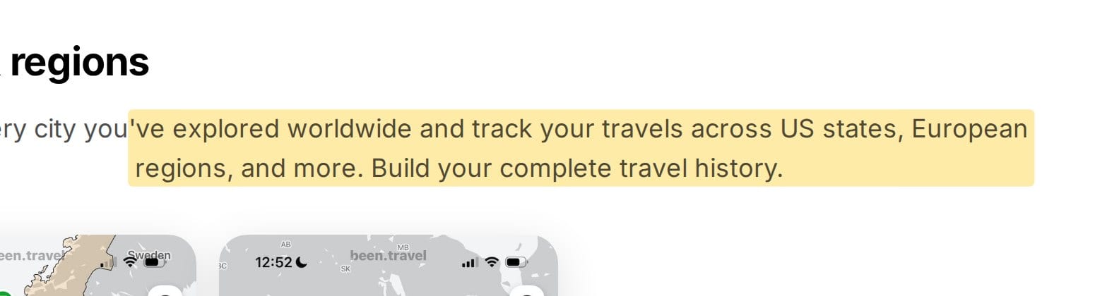
been od Prostachki obejmuje „stany USA, regiony europejskie i inne” oraz deklaruje, że „Wszystkie główne funkcje aplikacji Been są całkowicie darmowe”. Idzie to w parze z dziesięcioma osobnymi poziomami zakupów w aplikacji, w tym dożywotnią subskrypcją za $19,99, roczną za $29,99, miesięczną za $6,99 oraz subskrypcją tygodniową. Przeczytaj listę planów cenowych, zanim uwierzysz w hasło o darmowości.
been.travel · 2026-09-05
Visited
Visited funkcjonuje na rynku dłużej niż większość pozycji z tej listy i oferuje mapy regionalne dla ponad dwudziestu krajów, w tym USA. Z założenia wymagane jest konto: „Rejestracja gwarantuje, że Twoje dane są bezpiecznie zapisane na naszych serwerach i można uzyskać do nich dostęp z każdego urządzenia”.
W czym radzi sobie słabo: cennik jest labiryntem i nie został opublikowany w miejscu, w którym mogłoby się go szukać. Oficjalna strona wersji premium ogranicza się do stwierdzenia „Oferujemy trzy opcje płatności” bez podania kwot. App Store pokazuje, co to oznacza w praktyce: regiony za $3,99, miasta za $9,99, plany podróży za $7,99, usunięcie reklam za $3,99 oraz opcja dożywotnia za $59,99 górująca nad tym wszystkim. Użytkownik zainteresowany wyłącznie stanami płaci $3,99, po czym stale napotyka kolejne ograniczenia.
Stampie
Stampie tworzy paszport pełen pieczątek zamiast zamalowanej mapy, a oferowana kolekcja nosi na stronie nazwę „Wszystkie 50 stanów USA. Ostateczny amerykański roadtrip”. Wersja Pro to „jednorazowy zakup za $19,99”, obok aplikacji mobilnych dostępna jest wersja internetowa, a serwis udostępnia prawdziwy profil publiczny pod adresem stampie.app/@username zamiast zwykłego obrazka.
W czym radzi sobie słabo: kolekcja stanów jest dostępna wyłącznie w wersji Pro, zalogowanie się jest wymagane, zanim cokolwiek się wydarzy, a aplikacja jest na tyle nowa, że nie posiada jeszcze niezależnej bazy recenzji. Publikuje również na własnej domenie artykuły porównujące trackery, w których stawia siebie wyżej od konkurencji, dlatego należy traktować je jako materiały marketingowe.
Skratch
Skratch stawia na estetykę mapy do zdrapywania, a jej opis obiecuje możliwość zaznaczania: „odwiedzonych krajów, miast, stanów, regionów i atrakcji na całym świecie”. Odblokowanie regionów kosztuje $9,99, a aplikacja dysponuje największą realną bazą recenzji spośród prezentowanych tutaj płatnych programów.
W czym radzi sobie słabo: automatyczne wykrywanie miejsc przyznaje punkty na Twoją korzyść zbyt hojnie. Jeden z recenzentów zauważa: „oznacza mnie jako osobę, która odwiedziła Chiny, mimo że długa przesiadka nie liczy się tak naprawdę jako podróż”. W przypadku mapy stanów, gdzie przejazd samochodem przez dany stan już sam w sobie bywa przedmiotem dyskusji, aplikacja zgadująca zbyt optymistycznie stanowi poważny problem. Oficjalna strona w ogóle nie publikuje cen.
Dwie aplikacje wyłącznie dla USA
USA Travel: I've Been in US to jedyna znaleiziona przez nas aplikacja na system iOS, która łączy stany z hrabstwami, ciesząc się oceną 4,8 na podstawie około 2 200 opinii oraz aktualizacją z grudnia 2025 roku. Hrabstwa sprzedawane są osobno dla każdego stanu po $0,99 za sztukę, co oznacza, że Teksas z 254 hrabstwami oraz Kalifornia z 58 kosztują dokładnie tyle samo. W czym radzi sobie słabo: jeden z recenzentów podsumowuje wersję darmową słowami: „Jedyną darmową rzeczą jest mapa stanów oraz informacja, czy dany stan został odwiedzony, czy nie”.
US States Visited wygląda na oczywisty darmowy wybór, którego jednak należy unikać. Jej ostatnia aktualizacja pochodzi z grudnia 2023 roku, a recenzja opisuje próbę utworzenia drugiej mapy jako „zawieszającą aplikację na pustej stronie, która nie pozwala na absolutnie nic”. Porzucona aplikacja to gorsze miejsce na trzymanie piętnastoletniej historii danych niż karta w przeglądarce.
Trzy popularne aplikacje, które nie śledzą stanów
Ta sekcja pozwala zaoszczędzić pieniądze, ponieważ wszystkie trzy pozycje pojawiają się w wynikach wyszukiwania dla tych haseł, a żadna z nich nie odpowiada na postawione pytanie.
Polarsteps to doskonały dziennik podróży i słaby rejestrator stanów. Jej własna strona poświęcona śledzeniu podróży opisuje zbierane statystyki jako „Dystans, kraje i kroki gromadzące się w miarę przemieszczania się z miejsca na miejsce”. Stany, regiony i jednostki podziału terytorialnego w ogóle nie pojawiają się w dokumentacji. Wersja Plus kosztuje 8,99 EUR miesięcznie lub 29,99 EUR rocznie. Jako automatyczny dziennik podróży samochodowej z naniesioną faktyczną trasą to najlepszy produkt na tej stronie. Nie dowiesz się z niego jednak, że byłeś w 31 stanach.
Travelog śledzi kraje, miasta, punkty orientacyjne i linie lotnicze. Brak stanów. Aplikacja jest również bardzo nowa, ma ocenę 3,8 na podstawie pięciu opinii, a wskazana strona internetowa dewelopera to niemarkowa subdomena platformy Framer.
TravelGram śledzi wyłącznie kraje, ma ocenę 1,0 gwiazdki w amerykańskim App Store, jego własna domena nie działa, a w ofercie widnieje zakup w aplikacji za $59,99 obok opcji „dożywotniej” za $29,99 i tygodniowej subskrypcji za $2,99. Pojawia się w tym zestawieniu ze względu na pozycję w wyszukiwarce, a nie dlatego, że warto go rozważać.
Sformułowanie „Śledź miejsca, w których byłeś” prawie zawsze oznacza kraje. Przed zakupem upewnij się, że na oficjalnej stronie produktu pojawiło się słowo „stany” lub „regiony”. Trzy z czternastu narzędzi z tej listy oblewają ten test, a dwa z nich pobierają opłaty w formie subskrypcji.
Gdy 50 stanów przestaje wystarczać
Amerykanin podróżuje po kraju drogami lądowymi znacznie częściej niż samolotem. Wiosenna prognoza US Travel Association na 2026 rok szacuje liczbę krajowych podróży osób w 2025 roku na 2,40 miliarda, z czego 2,20 miliarda odbyło się samochodem, a 198,9 miliona samolotem. Przypada na to w przybliżeniu jedenaście podróży samochodowych na każdy lot. Przy tak dużej liczbie przejechanych kilometrów stany kończą się znacznie szybciej niż sam kraj. (Jeśli kluczowa jest sama jazda samochodem, nasza analiza poświęcona tematu ile naprawdę kosztuje podróż kamperem po USA w porównaniu do Europy przedstawia dokładne wyliczenia).
Hrabstwa
W 50 stanach i dystrykcie Waszyngton DC znajduje się 3 143 hrabstw i ich odpowiedników. Zliczanie hrabstw to prawdziwe hobby z zaangażowaną społecznością, a jego kanonicznym narzędziem jest Mob-Rule, który w tym miesiącu wciąż generuje swoje tablice wyników, a jego zasada jest uderzająco jasna: „odwiedzasz hrabstwo, a potem je zliczasz. Aby odwiedzić hrabstwo, wystarczy przekroczyć płaszczyznę jego granicy”.
To również sygnał ostrzegawczy. Konta osobiste przyznawane są po wysłaniu e-maila do właściciela, a strona rejestracji informuje wprost, że „Hasła są przechowywane na serwerze w postaci czystego tekstu i są czasami widoczne w adresach URL”. Użyj jednorazowego hasła lub skorzystaj z logowania jako gość. Fakt, że tak wygląda zaawansowane rozwiązanie, pokazuje, jak bardzo zaniedbane jest śledzenie hrabstw. Alternatywą są zakupy poszczególnych stanów w aplikacji USA Travel oraz darmowe warstwy hrabstw w serwisach TripProf USA, MapChart, VisitedPlaces i mapmaker.io.
Parki narodowe i mit dotyczący oficjalnej aplikacji
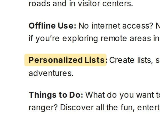
Ta kwestia często wprowadza ludzi w błąd. Oficjalna aplikacja National Park Service jest darmowa, dostępna na obu platformach i autentycznie dobra do map, wycieczek oraz pobierania danych offline. Nie śledzi jednak parków, które udało Ci się odwiedzić. Lista jej funkcji obejmuje „Listy personalizowane: Twórz listy, zapisuj miejsca parkowe, lokalizacje i dodawaj notatki”, ale nie oferuje niczego, co stemplowałoby paszport. Jeśli zainstalowałeś ją w oczekiwaniu na listę kontrolną, oto powód, dla którego nie mogłeś jej znaleźć.
www.nps.gov · 2026-09-05
Poznaj liczby, zanim przystąpisz do zliczania. System Parków Narodowych liczy 433 jednostki, spośród których 63 posiadają status „Parku Narodowego” według stanu na lipcowy 2026 rok, a jednostki te odnotowały 323 014 305 wizyt rekreacyjnych w 2025 roku, co oznacza spadek o 2,7% względem rekodu z 2024 roku. Jeśli chodzi o listę kontrolną parków, aplikacja Park'd obejmuje wszystkie 63 obiekty wraz z datami wizyt i jest dostępna wyłącznie na system iOS, z kolei Chimani oferuje funkcję zameldowania oraz historię wizyt w cenie 35,99 dolarów rocznie, przy czym jej darmowy plan został ograniczony z ponad 500 przewodników po parkach do około 70. Warto wiedzieć o tym przed zaplanowaniem wycieczki: ceny wstępów do parków uległy zmianie dla osób niebędących rezydentami, co omówiliśmy w przewodniku po dopłatach w parkach narodowych.
A co z Google My Maps?
Ludzie sięgają po to narzędzie, po czym rezygnują z dwóch powodów, o których warto wiedzieć wcześniej. Brak tu wbudowanych poligonów stanowych, co oznacza, że musisz ręcznie narysować pięćdziesiąt kształtów lub zaimportować granice, a narzędzie importu odrzuca pliki zawierające ponad 2 000 wierszy, co uniemożliwia wgranie pliku z hrabstwami w jednej warstwie. Po zbudowaniu mapy okazuje się również, że brak tu jakiegokolwiek eksportu do obrazu - do dyspozycji są tylko formaty KML, KMZ, pliki CSV dla poszczególnych warstw lub drukowanie. Jedyną ilustracją jest plik PDF z widocznymi drogami i etykietami Google prześwitującymi spod Twoich kolorowych wypełnień.
Które narzędzie powinieneś faktycznie wybrać
Wybieraj na podstawie tego, co chcesz osiągnąć, a nie suchej punktacji.
- TripProf USA dla hrabstw, linku do udostępniania i karty - za darmo
- VisitedPlaces, jeśli celem jest animowane wideo do publikacji
- TripMemo dla edytowalnego pliku SVG lub listy do druku
- MapChart, jeśli chcesz samodzielnie kontrolować każdy kolor
- been od REBR za jednorazowo $9,99, stany i hrabstwa, bez subskrypcji
- Stampie, jeśli profil publiczny ma większe znaczenie niż sama mapa
- Visited, jeśli już śledzisz regiony w wielu krajach
- Polarsteps, jeśli tak naprawdę zależy Ci na dzienniku podróży
Jeśli zliczasz kraje zamiast stanów, masz do czynienia z innym narzędziem i innym porównaniem. Nasza mapa świata znajduje się pod adresem world.tripprof.com, działa w ten sam sposób dla 195 krajów i zestawiliśmy ją z innymi trackerami krajów w artykule najlepsza aplikacja do śledzenia odwiedzonych krajów. Jedna statystyka z niej, której nikt inny nie może opublikować: na podstawie 472 map świata wypełnionych w serwisie tripprof.com, mediana liczby odwiedzonych krajów przez jedną osobę wynosiła 20 (stan na wrzesień 2026 roku).
Co i jak przetestowaliśmy
Wszystkie powyższe informacje o produktach pochodzą z ich własnych stron internetowych lub kart w amerykańskim App Store, przeczytanych we wrześniu 2026 roku, a nie z pamięci. Podane ceny odzwierciedlają stawki widoczne na tych stronach w tamtym dniu, a ponieważ kilka z tych serwisów zmienia plany cenowe, dane te mogą ulec przedawnieniu. Podobne porównania weryfikujemy ponownie co sześć miesięcy.
W przypadku darmowych narzędzi webowych mapy budowaliśmy ręcznie. Zrzuty ekranu z TripProf USA przedstawiają jeden konkretny profil: 29 stanów, dwa oznaczone jako miejsca zamieszkania, sześć hrabstw w Teksasie oraz 24 doświadczenia - jest to dokładnie ten profil, na podstawie którego wygenerowano kartę oraz wideo zamieszczone w tym artykule.
Pięć rzeczy, których nie udało nam się zweryfikować, w związku z czym nie twierdzimy, że są faktem. Strona internetowa ExplorersMap nie zwraca żadnych czytelnych treści, dlatego nie wysuwamy żadnych twierdzeń na jej temat. Witryny w Google Play nie zwracały czytelnych treści, w związku z czym wszystkie fakty dotyczące systemu Android pochodzą ze stron dostawców lub kart systemów iOS. Artykuł pomocy technicznej serwisu Polarsteps poświęcony statystykom odwiedzin zwraca błąd 403, dlatego stopień jego szczegółowości opieramy na stronach marketingowych. Nie przeprowadzaliśmy eksportu z MapChart, więc nie zajmujemy stanowiska w kwestii tego, czy darmowy plik PNG zawiera widoczny znak wodny, a jedynie odnotowujemy, że regulamin wymaga atrybucji. Nie znaleźliśmy również kontrolki pobierania obrazu w narzędziu do budowania map Randysa Majorsa, dlatego pominęliśmy je, zamiast zgadywać.
Publikujemy tego bloga, a jedno z czternastu narzędzi należy do nas, dlatego nasze słabe strony zostały opisane w tych samych akapitach co u wszystkich innych. Problem z wyczyszczoną przeglądarką jest realny, VisitedPlaces autentycznie wygrywa z nami pod względem opcji eksportu wideo, a płatne aplikacje faktycznie przewyższają nas zdolnością przetrwania przez całą dekadę.
Często zadawane pytania
Jaka jest najlepsza aplikacja do śledzenia odwiedzonych stanów w 2026 roku?
Dla darmowej mapy w dwie minuty bez zakładania konta - usa.tripprof.com w przeglądarce. Dla aplikacji, która zachowa mapę na lata i zsynchronizuje ją między urządzeniami - been od REBR w cenie $9,99 jako zakup jednorazowy. Obie obsługują hrabstwa, czego większość alternatyw nie robi.
Czy istnieje darmowa aplikacja do śledzenia odwiedzonych stanów USA?
Tak, kilka, choć te dobre darmowe rozwiązania to raczej strony internetowe niż aplikacje: TripProf USA, VisitedPlaces, TripMemo, MapChart, mapmaker.io oraz Maploco działają w przeglądarce bez instalacji. Wśród aplikacji wymagających instalacji darmowe plany są ubogie - been, Visited, Stampie oraz Skratch ukrywają stany za opłatą od $3,99 do $19,99.
W ilu stanach średnio był Amerykanin?
W szesnastu, nie licząc stanu, w którym mieszka, zgodnie z sondażem YouGov opublikowanym w czerwcu 2025 roku przeprowadzonym wśród 1 125 dorosłych mieszkańców USA. Powszechnie powtarzana liczba 12,5 pochodzi z badania Ipsos z 2016 roku, które uwzględniało stan rodzinny, dlatego obie wartości nie są bezpośrednio porównywalne.
Czy przejazd samochodem przez stan liczy się jako jego odwiedzenie?
Nie ma oficjalnej zasady, więc wybierz jedną i stosuj ją konsekwentnie. Powszechne kryteria to postawienie stopy poza pojazdem, spędzenie noclegu lub wykonanie jednej rzeczy, o której opowiedziałbyś komuś innemu. Większość trackerów pozostawia tę decyzję Tobie, co jest słuszne. Pamiętaj jednak, że aplikacje z funkcją automatycznego wykrywania mają tendencję do hojnego zaliczania miejsc.
Czy mogę śledzić hrabstwa w USA, a nie tylko stany?
Tak, choć wybór jest ograniczony. TripProf USA, MapChart, VisitedPlaces i mapmaker.io oferują obsługę hrabstw za darmo w przeglądarce. W wersji mobilnej been uwzględnia hrabstwa w płatnej wersji, a USA Travel sprzedaje je stan po stanie za $0,99. Narzędzie społecznościowe Mob-Rule działa od lat, ale jest dostępne wyłącznie w wersji webowej, a konta przyznawane są przez e-mail.
Czy oficjalna aplikacja National Park Service śledzi parki, które odwiedziłem?
Nie. Aplikacja NPS jest darmowa i przydatna do map, wycieczek oraz pobierania danych offline, ale jej możliwości kończą się na zapisywaniu miejsc i dodawaniu notatek. Brak w niej dziennika wizyt oraz stempli w paszporcie. Do prowadzenia listy kontrolnej 63 Parków Narodowych potrzebujesz innego narzędzia, takiego jak Park'd lub Chimani.
Ile jest stanów, hrabstw i parków narodowych w USA?
Pięćdziesiąt stanów oraz Dystrykt Kolumbii i pięć zamieszkałych terytoriów, co wyjaśnia, dlaczego narzędzia pokazują sumy wynoszące 50, 51 lub 56. Według Biura Spisowego w 50 stanach i DC znajduje się 3 143 hrabstw i ich odpowiedników, a po doliczeniu odpowiedników terytorialnych liczba ta wynosi około 3 231. System Parków Narodowych liczy 433 jednostki, z czego 63 posiadają status Parków Narodowych.
Najważniejsze wnioski
- Sprawdź, czy narzędzie obsługuje stany, zanim zapłacisz. Polarsteps, Travelog i TravelGram pojawiają się w wynikach wyszukiwania dla tych haseł, ale wszystkie śledzą wyłącznie kraje.
- Liczba 12,5 stanu pochodzi z 2016 roku. Aktualny wynik YouGov wynosi 16 stanów poza Twoim miejscem zamieszkania, mierzony w inny sposób, dlatego nie porównuj obu wartości bezpośrednio.
- Przeglądarka w zupełności wystarcza większości ludzi. usa.tripprof.com, VisitedPlaces, TripMemo oraz MapChart pozwalają stworzyć prawdziwą mapę stanów bez zakładania konta i bez instalacji.
- Zapisz link do udostępniania w stałym miejscu. Każde darmowe narzędzie webowe z tej listy zapisuje Twoją mapę w przeglądarce lub w adresie URL, a żadne z nich nie odesle jej z powrotem, jeśli ją utracisz.
- Płać raz zamiast co miesiąc. been za $9,99 i Stampie za $19,99 to zakupy jednorazowe; oferowane tu subskrypcje w większości kupują funkcje, których mapa stanów wcale nie potrzebuje.
- Hrabstwa to prawdziwy sprawdzian. Jest ich 3 143, niemal nic ich nie wspiera, a narzędzia, które to potrafią, zostały stworzone dla osób, które nieustannie ruszają w drogę.
Niezależnie od tego, co wybierzesz, najlepszy krok jest zawsze ten sam: wypełnij mapę dzisiaj z pamięci, a następnie pozwól jej korygować się w ciągu kolejnych kilku lat. To właśnie puste miejsca stanowią najciekawszą część.
Źródła
- YouGov, „Which states have Americans visited?”, czerwiec 2025
- Ipsos, „The average American has visited just 12 states”, lipiec 2016
- US Travel Association, Travel Forecast, wiosna 2026
- US Census Bureau, National Geographic Tallies
- National Park Service, The National Park System, zaktualizowano w lipcu 2026 r.
- National Park Service, statystyki odwiedzin za 2025 rok, marzec 2026 r.
- National Park Service, NPS Apps, zaktualizowano w maju 2026 r.
- Google My Maps, limity importu
Ostatnia aktualizacja: 19 września 2026
Czytaj dalej
Więcej porad i przewodników wybranych dla Ciebie

What counts as visiting a state? Layovers, drive-throughs and the rules 50-staters use
Only 2% of Americans name a plane change as the minimum that counts as visiting a state, while 27% set the bar at driving through. Here's a three-tier rubric, a lookup table for the edge cases from Four Corners to D.C., and one trip counted three ways.

Fałszywa strona z biletami SBB kradnie dane kart kredytowych i Twint podróżnych
Policja kantonu Zurych potwierdziła, że fałszywa strona internetowa z biletami SBB wykrada dane kart kredytowych i płatności Twint od podróżnych, którzy trafiają na nią przez zwykłą wyszukiwarkę Google. Oto jak ją rozpoznać i co zrobić, jeśli już zapłaciłeś.

Ostrzeżenie przed oszustwem na brytyjską ETA: fałszywe strony kasują Austriaków nawet 900 EUR
Fałszywe strony internetowe dotyczące brytyjskiej ETA pobierają od austriackich i unijnych podróżnych setki euro za wniosek, który kosztuje 20 GBP. Zobacz, jak działa oryginał i jak rozpoznać oszustwo przed zapłatą.